Colormaps
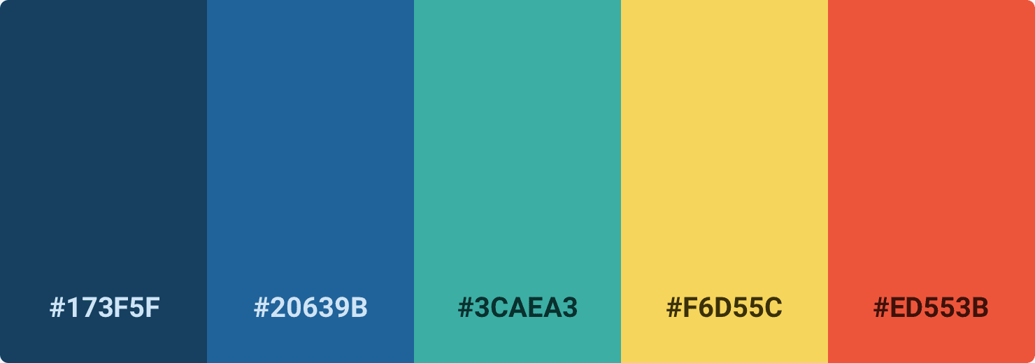
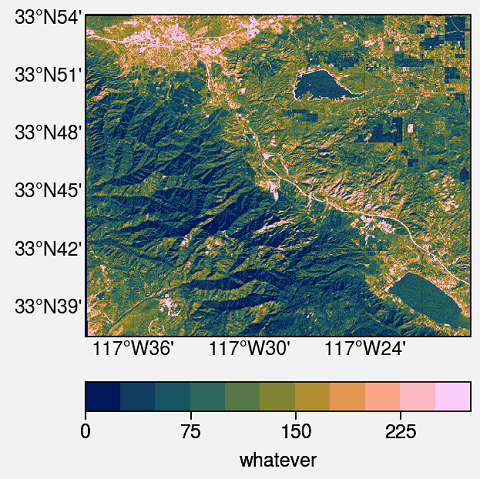
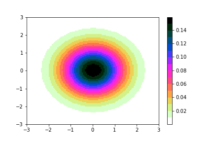
Description Colormaps is a library of collection of colormaps or color palettes for Python. It’s written in Python with matplotlib and numpy as dependencies....

Hi, I am Pratiman Patel, a PhD graduate from Indian Institute of Technology Bombay, India, and currently working as a postdoctoral researcher at the National University of Singapore, Singapore. My research interest is in urban climate, hydrology and remote sensing and geographic information system.
Description Colormaps is a library of collection of colormaps or color palettes for Python. It’s written in Python with matplotlib and numpy as dependencies....
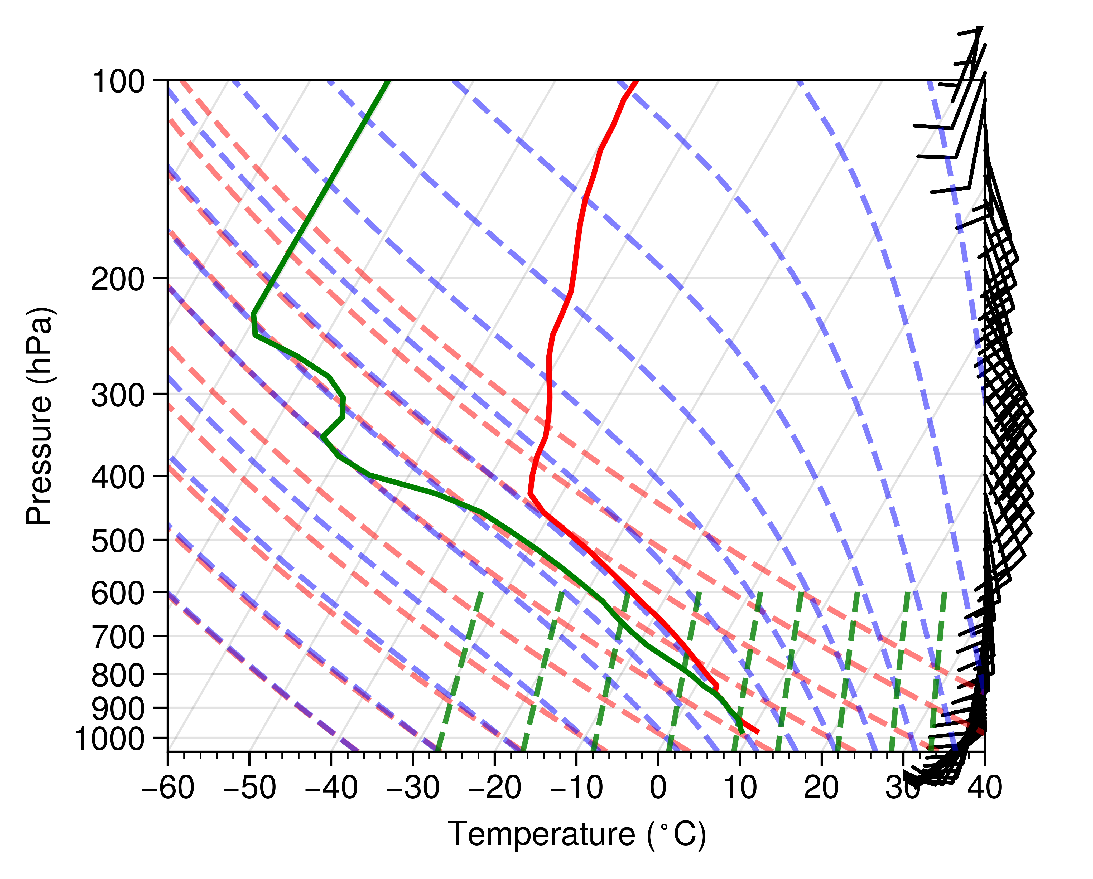
WRF Simple Sounding Using MetPy as straightforward as possible to make a Skew-T LogP plot for WRF out file. Required Libraries WRF-Python NetCDF4 M...
An excellent and interesting blog related to the building a new colour palette, which I find challenging to work. Use the following link: https://refactoring...
This is just for my understanding. I tend to forget things. Might be useful to others as well. # Importing stuff import imdlib as imd import geopandas from ...
This is intended for those who have never used python or just starting to work in python. Here are the steps which will help them with getting started with I...
Update [27 Feb 2021] For latest documentation, please visit https://imdlib.readthedocs.io/en/latest/ Now, you can convert the IMD dataset to GeoTIFF using d...
Go to this site: How to pick more beautiful colors for your data visualizations?!
The Weather Research and Forecasting (WRF) Model is a mesoscale numerical weather prediction system utilized worldwide for operational forecasts and research...
A simple and elegant method to convert NetCDF to GeoTIFF using python. Python Script import xarray as xr import rioxarray as rio #Open the NetCDF #Download...
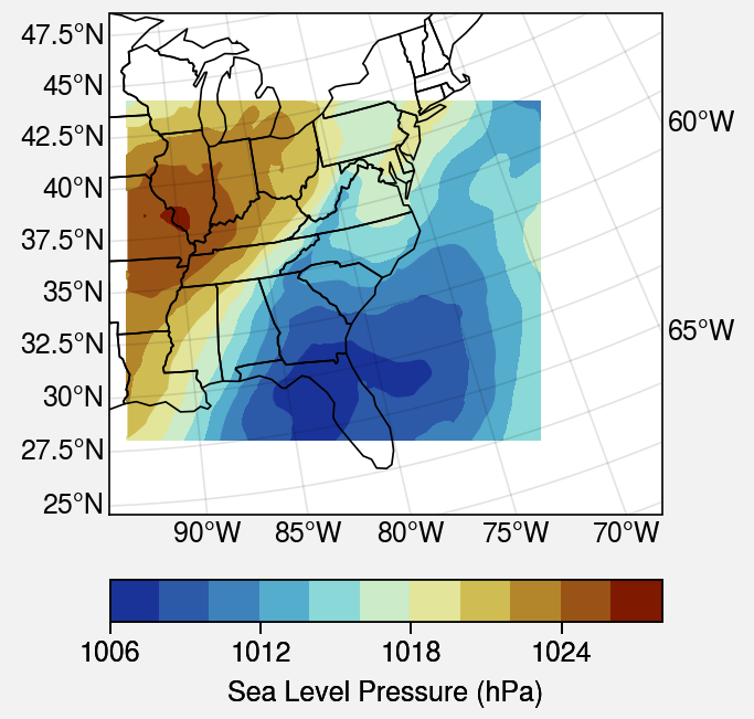
Here is an example of generating a surface plot from WRF output file. I find this method to be more elegent. Python Script import wrf from netCDF4 import Da...
The Weather Research and Forecasting (WRF) Model is a mesoscale numerical weather prediction system utilized worldwide for operational forecasts and research...
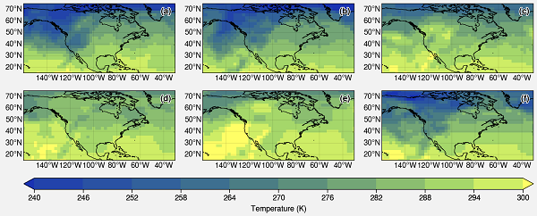
Usually, working with met data, you have to plot multiple figures. Here, we plot 6 plots in the same figure including plot numbers. First of all load your d...
Usually, working with geographic data, you have to use GIS software. For plotting multiple plots with the same quality might be cumbersome. Hence, some peopl...